
Obrigado por apoiar este site ❤️
Faça uma doação
Faça uma doação
Mapa topográfico Rabbit Island
Clique no mapa para exibir a altitude.
Obrigado por apoiar este site ❤️
Faça uma doação
Faça uma doação
Sobre este mapa
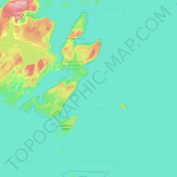
Nome: Mapa topográfico Rabbit Island, altitude, relevo.
Altitude média: 187 m
Altitude mínima: 170 m
Altitude máxima: 329 m
Obrigado por apoiar este site ❤️
Faça uma doação
Faça uma doação