
Mapa topográfico Pinyon Pines
Mapa interativo
Clique no mapa para exibir a altitude.
Sobre este mapa
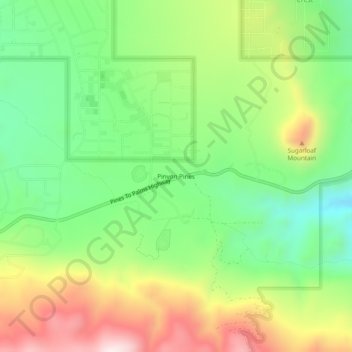
Nome: Mapa topográfico Pinyon Pines, altitude, relevo.
Altitude média: 1.276 m
Altitude mínima: 1.040 m
Altitude máxima: 1.621 m
It is located in a small valley between the San Jacinto Mountains and Santa Rosa Mountains, north of State Route 74. It takes its name from the Pinyon pine (Pinus monophylla) trees native to the area. Pinyon Pines sits at an elevation of approximately 4000 feet.