
Mapa topográfico Sisak
Mapa interativo
Clique no mapa para exibir a altitude.
Sobre este mapa
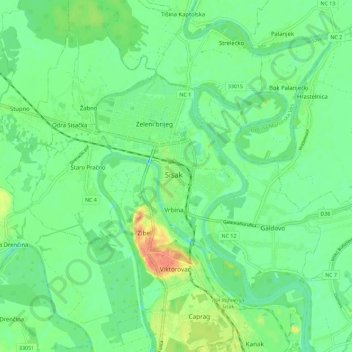
Nome: Mapa topográfico Sisak, altitude, relevo.
Local: Sisak, Grad Sisak, Sisak-Moslavina County, 44000, Croatia (45.44883 16.33548 45.52883 16.41548)
Altitude média: 98 m
Altitude mínima: 83 m
Altitude máxima: 127 m
Sisak (Croatian: ; Hungarian: Sziszek ; also known by other alternative names) is a city and episcopal see in central Croatia, located at the confluence of the Kupa, Sava and Odra rivers, 57 km (35 mi) southeast of the Croatian capital Zagreb, and is usually considered to be where the Posavina (Sava basin) begins, with an elevation of 99 m. The city's total population in 2011 was 47,768 of which 33,322 live in the urban settlement (naselje).
Outros mapas topográficos
Clique em um mapa para visualizar sua topografia, sua altitude e seu relevo.