
Mapa topográfico Crested Butte
Mapa interativo
Clique no mapa para exibir a altitude.
Sobre este mapa
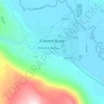
Nome: Mapa topográfico Crested Butte, altitude, relevo.
Altitude média: 2.798 m
Altitude mínima: 2.693 m
Altitude máxima: 3.177 m
Crested Butte is located in north-central Gunnison County on the west side of the valley of the Slate River, along Coal Creek. Colorado State Highway 135 runs south from Crested Butte 27 miles (43 km) to Gunnison, the county seat. According to the United States Census Bureau, the town of Crested Butte has a total area of 0.85 square miles (2.2 km2), all of it land. Crested Butte lies at an elevation of 8,885 feet (2,708 m) above sea level.