
Obrigado por apoiar este site ❤️
Faça uma doação
Faça uma doação
Mapa topográfico Gieten
Clique no mapa para exibir a altitude.
Obrigado por apoiar este site ❤️
Faça uma doação
Faça uma doação
Sobre este mapa
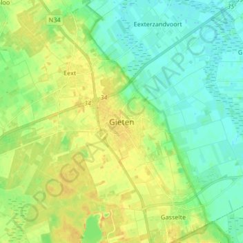
Nome: Mapa topográfico Gieten, altitude, relevo.
Local: Gieten, Drenthe, Nederland, 9461, Nederland (52.96331 6.72391 53.04331 6.80391)
Altitude média: 12 m
Altitude mínima: 1 m
Altitude máxima: 27 m
Obrigado por apoiar este site ❤️
Faça uma doação
Faça uma doação