
Obrigado por apoiar este site ❤️
Faça uma doação
Faça uma doação
Mapa topográfico Bradninch
Clique no mapa para exibir a altitude.
Obrigado por apoiar este site ❤️
Faça uma doação
Faça uma doação
Sobre este mapa
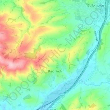
Nome: Mapa topográfico Bradninch, altitude, relevo.
Local: Bradninch, Mid Devon, Devon, England, United Kingdom (50.80813 -3.47034 50.86018 -3.38719)
Altitude média: 104 m
Altitude mínima: 35 m
Altitude máxima: 245 m
Obrigado por apoiar este site ❤️
Faça uma doação
Faça uma doação
Outros mapas topográficos
Clique em um mapa para visualizar sua topografia, sua altitude e seu relevo.