
Mapa topográfico Großer Feldberg
Clique no mapa para exibir a altitude.
Großer Feldberg
The Großer Feldberg ('Great Field Mountain') is, at a height of 879.5 metres, the highest elevation of the Taunus mountains, and of the entire Rhenish Massif. It is situated in the Hochtaunuskreis district in Hesse, Germany.
Sobre este mapa
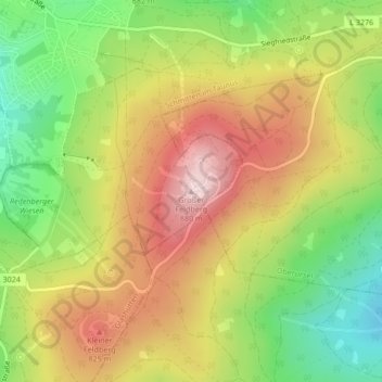
Nome: Mapa topográfico Großer Feldberg, altitude, relevo.
Altitude média: 716 m
Altitude mínima: 549 m
Altitude máxima: 884 m