
Faça uma doação
Mapa topográfico Koyo Zom
Clique no mapa para exibir a altitude.
Faça uma doação
Sobre este mapa
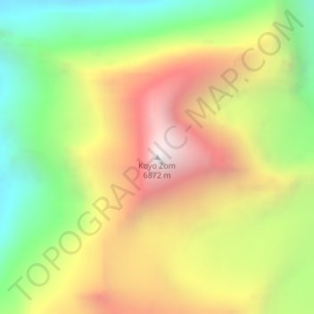
Nome: Mapa topográfico Koyo Zom, altitude, relevo.
Altitude média: 5.925 m
Altitude mínima: 5.096 m
Altitude máxima: 6.835 m
Faça uma doação
Outros mapas topográficos
Clique em um mapa para visualizar sua topografia, sua altitude e seu relevo.
Drosh Tehsil
Pakistan > Khyber Pakhtunkhwa > Chitrāl District
Khowar is by the majority of the people in Drosh with a few speakers of Pashto. Drosh is low elevation and is a large village in Chitral District on the traditional trade route to Drosh-Jalalabad Road.
Altitude média: 3.012 m
Bamburait River
Pakistan > Khyber Pakhtunkhwa > Chitrāl District > Chitral Tehsil
Altitude média: 2.999 m
Faça uma doação
Upper Gazikistan Glacier
Pakistan > Khyber Pakhtunkhwa > Chitrāl District > Chitral Tehsil
Altitude média: 5.086 m
Mastuj Tehsil
Pakistan > Khyber Pakhtunkhwa > Chitrāl District
Mastuj (Urdu: مستوج) is a tehsil of Upper Chitral District in Khyber-Pakhtunkhwa province of Pakistan; Mastuj is the principal settlement. It is located at 36°17'0N 72°31'0E with an altitude of 2359 metres (7742 feet). There are ruins of old fort built originally in 18th century and reconstructed several times.
Altitude média: 4.143 m
Water Flow
Pakistan > Khyber Pakhtunkhwa > Chitrāl District > Chitral Tehsil > Parsan
Altitude média: 2.981 m