
Mapa topográfico Quinwood
Mapa interativo
Clique no mapa para exibir a altitude.
Quinwood
With the elevation and location on a western facing slope, Quinwood can easily see significant amounts of snowfall when winds from the northwest carry moisture from the great lakes and ride up the mountains. This event is called orographic lift. Snowfall amounts over one foot are very common during these events. In 2012, Hurricane Sandy left 29 inches (74 cm) of snow in Quinwood.
Sobre este mapa
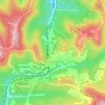
Nome: Mapa topográfico Quinwood, altitude, relevo.
Altitude média: 939 m
Altitude mínima: 827 m
Altitude máxima: 1.059 m