
Obrigado por apoiar este site ❤️
Faça uma doação
Faça uma doação
Mapa topográfico Eccles Pike
Clique no mapa para exibir a altitude.
Obrigado por apoiar este site ❤️
Faça uma doação
Faça uma doação
Eccles Pike
At the top of the hill is a commemorative plaque known as a topograph, showing a 360° relief of the surrounding landscape, placed by the community to mark the millennium. In early November 2011, the topograph was stolen. On 7 May 2013, it was replaced with one made from less valuable metal to discourage future theft.
Obrigado por apoiar este site ❤️
Faça uma doação
Faça uma doação
Sobre este mapa
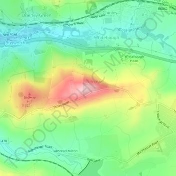
Nome: Mapa topográfico Eccles Pike, altitude, relevo.
Altitude média: 233 m
Altitude mínima: 161 m
Altitude máxima: 361 m
Obrigado por apoiar este site ❤️
Faça uma doação
Faça uma doação