
Obrigado por apoiar este site ❤️
Faça uma doação
Faça uma doação
Mapa topográfico Hopland
Clique no mapa para exibir a altitude.
Obrigado por apoiar este site ❤️
Faça uma doação
Faça uma doação
Hopland
Hopland (formerly Sanel) is a census-designated place in Mendocino County, California, United States. It is located on the west bank of the Russian River 13 miles (21 km) south-southeast of Ukiah, in the Sanel Valley, at an elevation of 502 feet (153 m). The population was 661 at the 2020 census, down from 756 at the 2010 census.
Obrigado por apoiar este site ❤️
Faça uma doação
Faça uma doação
Sobre este mapa
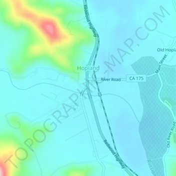
Nome: Mapa topográfico Hopland, altitude, relevo.
Local: Hopland, Mendocino County, California, United States (38.96334 -123.12672 38.97641 -123.11028)
Altitude média: 165 m
Altitude mínima: 139 m
Altitude máxima: 314 m
Obrigado por apoiar este site ❤️
Faça uma doação
Faça uma doação