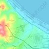
Mapa topográfico Taranta Peligna
Clique no mapa para exibir a altitude.
Taranta Peligna
From the base the opening is similar to a large bird's nest; the grandeur and impressiveness of the entrance on the fantastic wall is striking. The cave consists of a series of conduits and concrectioned rooms, equipped for tourist visits for about 800 meters, whose topography is largely governed by characters of D'Annunzio's tragedy The daughter of Iorio and more or less happy similarities. It is also called Grotta della figlia di Iorio ('Cave of the Daughter of Iorio') because Francesco Paolo Michetti took inspiration from the entrance cave for the scenography of the second act of D'Annunzio's tragedy that was staged at the Teatro Lirico in Milan on March 4, 1904; and in the wake of the success of the vates' work, the cave attracted numerous visitors and scholars, many of whom described it in imaginative terms and rich in inspired metaphors.
Sobre este mapa
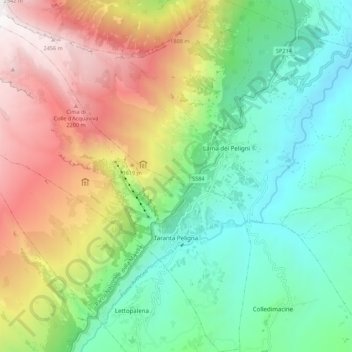
Nome: Mapa topográfico Taranta Peligna, altitude, relevo.
Local: Taranta Peligna, Chieti, Abruzzo, 66018, Italy (41.99453 14.09971 42.07564 14.19390)
Altitude média: 1.117 m
Altitude mínima: 281 m
Altitude máxima: 2.539 m
Outros mapas topográficos
Clique em um mapa para visualizar sua topografia, sua altitude e seu relevo.