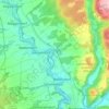
Mapa topográfico Fichtelberg
Clique no mapa para exibir a altitude.
Fichtelberg
The history of the site at Fichtelberg is dominated by ore mining of the mining company Erzgrube Gottesgab im Gleißingerfels am Fichtelberg. In 1600 the uppermost reaches of the Fichtelnaab valley near the present villages of Neubau and Fichtelberg was still covered with a rugged, forest-covered wilderness. Finds, such as a serpentine pendant in 1922 on the Ochsenkopf or a stone axe head excavated in 1935 east of Fichtelberg, suggest that the area around Fichtelberg was already inhabited in the Neolithic period, at least by hunters passing through. The absence of other finds, however, rules out any permanent settlement until the beginning of the 17th century. This was probably due to the steep slopes and significantly higher altitude along with a harsh climate and less fertile soils. Iron ore mining in the upper Fichtelnaab valley began in 1478, but only a small settlement of a few houses extended from the south up to the outskirts of what is now Fichtelberg today.
Sobre este mapa

Nome: Mapa topográfico Fichtelberg, altitude, relevo.
Local: Fichtelberg, Landkreis Bayreuth, Bavaria, 95686, Germany (49.97317 11.82764 50.02111 11.87379)
Altitude média: 697 m
Altitude mínima: 589 m
Altitude máxima: 875 m
Outros mapas topográficos
Clique em um mapa para visualizar sua topografia, sua altitude e seu relevo.




Bad Berneck
Germany > Bavaria > Landkreis Bayreuth > Bad Berneck im Fichtelgebirge
Altitude média: 474 m