
Obrigado por apoiar este site ❤️
Faça uma doação
Faça uma doação
Mapa topográfico Dunstable Downs
Clique no mapa para exibir a altitude.
Obrigado por apoiar este site ❤️
Faça uma doação
Faça uma doação
Dunstable Downs
Because of its elevation, Dunstable Downs hosted a station in the shutter telegraph chain which connected the Admiralty in London to its naval ships in the port of Great Yarmouth during the years 1808 to 1814.
Obrigado por apoiar este site ❤️
Faça uma doação
Faça uma doação
Sobre este mapa
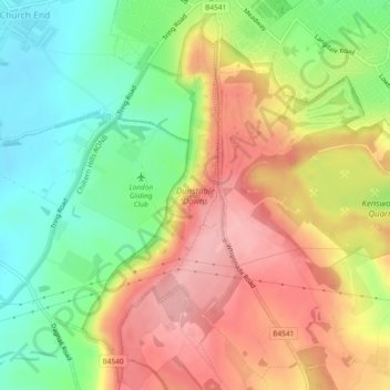
Nome: Mapa topográfico Dunstable Downs, altitude, relevo.
Altitude média: 178 m
Altitude mínima: 112 m
Altitude máxima: 245 m
Obrigado por apoiar este site ❤️
Faça uma doação
Faça uma doação