
Faça uma doação
Mapa topográfico Belvidere
Clique no mapa para exibir a altitude.
Faça uma doação
Belvidere
Belvidere developed on both sides of the Kishwaukee River in north central Illinois. It is 76 miles from downtown Chicago on Routes 20, 76 and the Northern Illinois Toll road. Belvidere is an industrial community surrounded by prosperous farms. It is the County Seat with an estimated 2006 county population of over 52,000. The altitude is 800 feet above sea level, average temperatures are: 73 degrees F in the summer; 24 degrees F in the winter, and the average rainfall is 33.3 inches, and the average annual snowfall is 35.3 inches.
Faça uma doação
Sobre este mapa
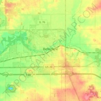
Nome: Mapa topográfico Belvidere, altitude, relevo.
Altitude média: 244 m
Altitude mínima: 208 m
Altitude máxima: 282 m
Faça uma doação
Outros mapas topográficos
Clique em um mapa para visualizar sua topografia, sua altitude e seu relevo.