
Mapa topográfico Suez Canal
Mapa interativo
Clique no mapa para exibir a altitude.
Sobre este mapa
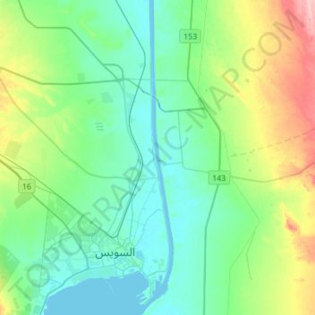
Nome: Mapa topográfico Suez Canal, altitude, relevo.
Local: Suez Canal, Suez, Egypt (29.92639 32.55958 30.16442 32.58845)
Altitude média: 39 m
Altitude mínima: -3 m
Altitude máxima: 161 m
Despite the construction challenges that could have been the result of the alleged difference in sea levels, the idea of finding a shorter route to the east remained alive. In 1830, General Francis Chesney submitted a report to the British government that stated that there was no difference in elevation and that the Suez Canal was feasible, but his report received no further attention. Lieutenant Waghorn established his "Overland Route", which transported post and passengers to India via Egypt.
Outros mapas topográficos
Clique em um mapa para visualizar sua topografia, sua altitude e seu relevo.