
Obrigado por apoiar este site ❤️
Faça uma doação
Faça uma doação
Mapa topográfico Mount San Cristobal
Clique no mapa para exibir a altitude.
Obrigado por apoiar este site ❤️
Faça uma doação
Faça uma doação
Mount San Cristobal
Mount San Cristobal is a potentially active stratovolcano at the boundary of the provinces of Laguna and Quezon on the island of Luzon, Philippines. The mountain rises to an elevation of 1,470 m (4,820 ft) above mean sea level and is one of the volcanic features of Macolod Corridor.
Obrigado por apoiar este site ❤️
Faça uma doação
Faça uma doação
Sobre este mapa
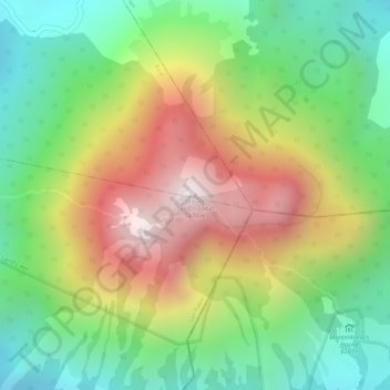
Nome: Mapa topográfico Mount San Cristobal, altitude, relevo.
Altitude média: 1.021 m
Altitude mínima: 665 m
Altitude máxima: 1.463 m
Obrigado por apoiar este site ❤️
Faça uma doação
Faça uma doação
Outros mapas topográficos
Clique em um mapa para visualizar sua topografia, sua altitude e seu relevo.