
Faça uma doação
Mapa topográfico Monte Lake
Clique no mapa para exibir a altitude.
Faça uma doação
Sobre este mapa
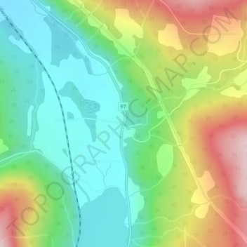
Nome: Mapa topográfico Monte Lake, altitude, relevo.
Altitude média: 790 m
Altitude mínima: 665 m
Altitude máxima: 1.003 m
Faça uma doação
Outros mapas topográficos
Clique em um mapa para visualizar sua topografia, sua altitude e seu relevo.
Vancouver
Canada > British Columbia > Metro Vancouver Regional District
Vancouver, British Columbia, is situated on the Burrard Peninsula, bordered by Burrard Inlet to the north and the Fraser River to the south. The city's topography is a blend of flat and hilly terrains, with elevations ranging from sea level to approximately 152 meters (500 feet) above sea level. The North…
Altitude média: 34 m
Victoria
Canada > British Columbia > Capital Regional District
Victoria, British Columbia, is situated on the southern tip of Vancouver Island, Canada, and boasts a diverse and varied topography. The city is characterized by rolling hills, rugged coastal cliffs, and lush valleys, providing a striking contrast between mountainous terrain and flatland areas. To the north…
Altitude média: 17 m
Vancouver Island
The rain shadow effect of the island's mountains, as well as the mountains of Washington's Olympic Peninsula, creates wide variation in precipitation. The west coast is considerably wetter than the east coast. Average annual precipitation ranges from 6,650 mm (262 in) at Hucuktlis Lake on the west coast…
Altitude média: 411 m
Faça uma doação
Kelowna
Canada > British Columbia > Regional District of Central Okanagan
Kelowna is classified as a humid continental climate or an inland oceanic climate per the Köppen climate classification system due to its coldest month having an average temperature slightly above −3.0 °C (26.6 °F) and below 0 °C (32 °F), with dry, hot, sunny summers and cool, cloudy winters, and four…
Altitude média: 704 m
Faça uma doação
Coquitlam
Canada > British Columbia > Metro Vancouver Regional District
Like much of Metro Vancouver, Coquitlam has an oceanic climate (Köppen climate type Cfb), experiencing mild temperatures and high precipitation; warm, dry summers and cool, wet winters. However, compared to most other cities in the area, precipitation is especially heavy in Coquitlam due to its proximity to…
Altitude média: 190 m
Faça uma doação
Prince George
Canada > British Columbia > Regional District of Fraser-Fort George
The area has a humid continental climate (Köppen climate classification Dfb, Trewartha Dclo), but is close to (and once had) a subarctic climate (Dfc) as May and September averages are both close to the 10 °C (50 °F) threshold. Winters are milder than the latitude and elevation might suggest: the January…
Altitude média: 685 m
Burnaby
Canada > British Columbia > Metro Vancouver Regional District
Burnaby occupies 98.6 square kilometres (38.1 sq mi) and is located at the geographic centre of the Metro Vancouver Regional District. The regional district's government is located in Burnaby's Metrotown area. Situated between the city of Vancouver on the west and Port Moody, Coquitlam, and New Westminster on…
Altitude média: 59 m
Township of Langley
Canada > British Columbia > Metro Vancouver Regional District
Altitude média: 47 m
Faça uma doação
Prince Rupert
Canada > British Columbia > North Coast Regional District
Prince Rupert Airport (YPR/CYPR) is on Digby Island. Its position is 54°17′10″N 130°26′41″W / 54.28611°N 130.44472°W / 54.28611; -130.44472, and its elevation is 35 m (116 ft) above sea level. The airport consists of one runway, one passenger terminal, and two aircraft stands. Access to…
Altitude média: 91 m
Faça uma doação
South Surrey
Canada > British Columbia > Metro Vancouver Regional District > Surrey
Altitude média: 28 m
Faça uma doação
Faça uma doação
Pennask Lake
Canada > British Columbia > Thompson-Nicola Regional District > Area M (Beautiful Nicola Valley - North)
Altitude média: 1.430 m
Faça uma doação
Penticton
Canada > British Columbia > Regional District of Okanagan-Similkameen
Penticton is located at the geographical coordinates of 49°29′28″N 119°35′19″W / 49.49111°N 119.58861°W / 49.49111; -119.58861 (Penticton) and covers an area of 42.10 km2 (16.25 sq mi), with a maximum north–south distance of 7 km (4.3 mi) wide between the Okanagan Lake to the north…
Altitude média: 702 m
Saltspring Island
Canada > British Columbia > Capital Regional District > Salt Spring Island Electoral Area
Altitude média: 72 m
Lundbom Lake
Canada > British Columbia > Thompson-Nicola Regional District > Area N (Beautiful Nicola Valley - South)
Altitude média: 1.158 m
Faça uma doação
Galiano Island
Canada > British Columbia > Capital Regional District > Southern Gulf Islands Electoral Area
Altitude média: 24 m
North Pender Island
Canada > British Columbia > Capital Regional District > Southern Gulf Islands Electoral Area
Altitude média: 23 m
Vancouver Island
The rain shadow effect of the island's mountains, as well as the mountains of Washington's Olympic Peninsula, creates wide variation in precipitation. The west coast is considerably wetter than the east coast. Average annual precipitation ranges from 6,650 mm (262 in) at Hucuktlis Lake on the west coast…
Altitude média: 411 m
Faça uma doação
Revelstoke
Canada > British Columbia > Columbia-Shuswap Regional District
A small ski resort featuring a single short lift has operated on Mount MacKenzie since the 1960s, and snowcat skiing was offered for higher altitudes. A strong movement pushed to expand the entire mountain into a single resort, and construction started in the early 2000s (decade).
Altitude média: 982 m
Faça uma doação
Mayne Island
Canada > British Columbia > Capital Regional District > Southern Gulf Islands Electoral Area > Mayne
Altitude média: 26 m
Texada Island
Canada > British Columbia > qathet Regional District > Area D (Texada Island)
Altitude média: 83 m
Faça uma doação
Hornby Island
Canada > British Columbia > Comox Valley Regional District > Area A (Baynes Sound)
Altitude média: 27 m
Glacier National Park
Canada > British Columbia > Columbia-Shuswap Regional District
Altitude média: 1.881 m
Trout Lake
Canada > British Columbia > Metro Vancouver Regional District > Vancouver
Altitude média: 52 m
Faça uma doação
Mundy Park
Canada > British Columbia > Metro Vancouver Regional District > Coquitlam
Altitude média: 139 m
Goldstream River
Canada > British Columbia > Capital Regional District > Juan de Fuca Electoral Area
Altitude média: 247 m
Faça uma doação
Quadra Island
Canada > British Columbia > Strathcona Regional District > Area B (Discovery Islands/Mainland Inlets)
Altitude média: 128 m
Faça uma doação
Golden Ears Provincial Park
Canada > British Columbia > Metro Vancouver Regional District
Altitude média: 794 m
Strathcona Provincial Park
Canada > British Columbia > Strathcona Regional District
Altitude média: 703 m
Faça uma doação
Chilliwack Lake
Canada > British Columbia > Fraser Valley Regional District > Area E (Chilliwack River Valley)
Altitude média: 1.152 m
Faça uma doação
Adams Lake
Canada > British Columbia > Thompson-Nicola Regional District > Area O (Lower North Thompson)
According to one account, the lake is 63 kilometres (39 mi) long and 1.6 to 3.2 kilometres (1.0 to 2.0 mi) wide. The surface elevation is 404 metres (1,325 ft) above sea level. The mean depth of 299 metres (981 ft) and maximum depth of 457 metres (1,499 ft) make the second deepest lake in BC (next to Quesnel…
Altitude média: 1.177 m
Stanley Park
Canada > British Columbia > Metro Vancouver Regional District > Vancouver
Altitude média: 14 m
Faça uma doação
Mission
Canada > British Columbia > Fraser Valley Regional District
The western part of the district, the Stave Valley, is largely rural and forested but its watercourse is home to what was the largest hydroelectric project in British Columbia until the Bridge River Power Project opened in 1961. It was built by the British Columbia Electric Railway (BCER) to provide power to…
Altitude média: 345 m
Vancouver
Canada > British Columbia > Metro Vancouver Regional District
Vancouver, British Columbia, is situated on the Burrard Peninsula, bordered by Burrard Inlet to the north and the Fraser River to the south. The city's topography is a blend of flat and hilly terrains, with elevations ranging from sea level to approximately 152 meters (500 feet) above sea level. The North…
Altitude média: 34 m
Faça uma doação
Kimberley
Canada > British Columbia > Regional District of East Kootenay
Kimberley has a continental climate with semi-arid influences and heavy moderation from the nearby mountains which tend to block arctic air masses, and produce a rain shadow. Its fairly high elevation counters this effect slightly, as temperatures are somewhat cooler and the town slightly more rainy than it…
Altitude média: 1.216 m
Faça uma doação
Kootenay National Park
Canada > British Columbia > Regional District of East Kootenay
Kootenay National Park is a national park located in southeastern British Columbia, Canada, and is one component of the Canadian Rocky Mountain Parks World Heritage Site. The park consists of 1,406 km2 (543 sq mi) of the Canadian Rockies, including parts of the Kootenay and Park mountain ranges, the Kootenay…
Altitude média: 1.832 m
Faça uma doação
Valdes Island
Canada > British Columbia > Cowichan Valley Regional District > Area G (Saltair / Gulf Islands)
Altitude média: 11 m
Vancouver East
Canada > British Columbia > Metro Vancouver Regional District > Vancouver
Altitude média: 25 m
Area C (Long Beach)
Canada > British Columbia > Alberni-Clayoquot Regional District
Altitude média: 316 m
Faça uma doação
Area D (Falkland/Silver Creek)
Canada > British Columbia > Columbia-Shuswap Regional District
Altitude média: 958 m
Aldergrove
Canada > British Columbia > Metro Vancouver Regional District > Township of Langley
Altitude média: 107 m
North Delta
Canada > British Columbia > Metro Vancouver Regional District > Delta
Altitude média: 48 m
Faça uma doação
Golden Ears
Canada > British Columbia > Metro Vancouver Regional District > Maple Ridge
Altitude média: 189 m
Sea Island
Canada > British Columbia > Metro Vancouver Regional District > Richmond
Altitude média: 6 m
Summerland
Canada > British Columbia > Regional District of Okanagan-Similkameen
Altitude média: 696 m
Faça uma doação
Faça uma doação