Geolocalizar

Mapa topográfico Isle of Sheppey

Mapa interativo

Clique no mapa para exibir a altitude.

Sobre este mapa

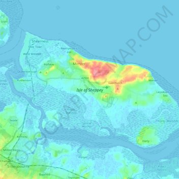
Nome: Mapa topográfico Isle of Sheppey, altitude, relevo.

Local: Isle of Sheppey, Borough of Swale, Kent, England, United Kingdom (51.35449 0.72172 51.44779 0.95090)

Altitude média: 6 m

Altitude mínima: -4 m

Altitude máxima: 74 m

Outros mapas topográficos

Clique em um mapa para visualizar sua topografia, sua altitude e seu relevo.

Sheerness

United Kingdom > England > Kent > Borough of Swale

Sheerness, Borough of Swale, Kent, England, United Kingdom

Altitude média: 3 m

Teynham

United Kingdom > England > Kent > Borough of Swale > Conyer

Teynham, Conyer, Borough of Swale, Kent, England, United Kingdom

Altitude média: 6 m