
Mapa topográfico Benbecula
Mapa interativo
Clique no mapa para exibir a altitude.
Sobre este mapa
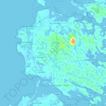
Nome: Mapa topográfico Benbecula, altitude, relevo.
Local: Benbecula, Creagorry, Western Isles, Scotland, United Kingdom (57.39877 -7.41199 57.49401 -7.19778)
Altitude média: 5 m
Altitude mínima: -4 m
Altitude máxima: 121 m
There is a dense cluster of lochs across almost the entire island, and almost all of the island is below 20 metres (70 feet) in elevation.