
Obrigado por apoiar este site ❤️
Faça uma doação
Faça uma doação
Mapa topográfico Monteagle
Clique no mapa para exibir a altitude.
Obrigado por apoiar este site ❤️
Faça uma doação
Faça uma doação
Monteagle
The town straddles a narrow stretch of the Cumberland Plateau known colloquially as "Monteagle Mountain". This stretch of the plateau is approximately 2 miles (3 km) wide, with steep drop-offs to the northwest and southeast. Monteagle lies at an elevation of just under 2,000 feet (610 m) above sea level. By comparison, two nearby cities, Cowan (to the northwest) and South Pittsburg (to the southeast), lie at elevations of less than 1,000 feet (300 m) above sea level.
Obrigado por apoiar este site ❤️
Faça uma doação
Faça uma doação
Sobre este mapa
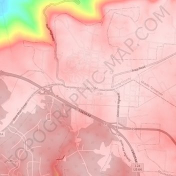
Nome: Mapa topográfico Monteagle, altitude, relevo.
Altitude média: 566 m
Altitude mínima: 318 m
Altitude máxima: 595 m
Obrigado por apoiar este site ❤️
Faça uma doação
Faça uma doação