

Mapa topográfico Limpsfield
Clique no mapa para exibir a altitude.
Limpsfield
The civil and ecclesiastical parish area is grouped to the north and south of Hurst Green, Surrey. The built up section is north of Hurst Green and both east and north-east of Oxted. The lowest elevation is 62m at Staffhurst Wood on the south-western parish boundary on the River Eden, Kent and highest is just east of the town centre at Grubstreet Copse at 163m; (Titsey being a separate civil parish north of the village and higher on the North Downs).
Sobre este mapa
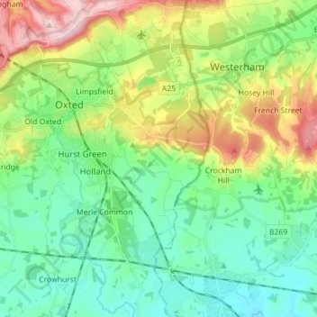
Nome: Mapa topográfico Limpsfield, altitude, relevo.
Altitude média: 110 m
Altitude mínima: 37 m
Altitude máxima: 271 m