
Obrigado por apoiar este site ❤️
Faça uma doação
Faça uma doação
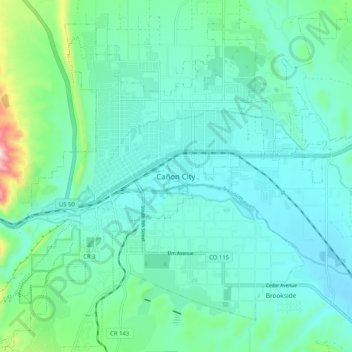
Mapa topográfico Cañon City
Clique no mapa para exibir a altitude.
Obrigado por apoiar este site ❤️
Faça uma doação
Faça uma doação
Cañon City
The city's nickname, "the Climate Capital of Colorado", derives from the combination of unique geography and 5,300-foot (1,600 m) elevation protecting the city from harsh weather conditions. The average daily high temperature in January is 14 °F (7.8 °C) warmer in Cañon City than in Grand Junction, even though the elevation of Cañon City is higher.
Obrigado por apoiar este site ❤️
Faça uma doação
Faça uma doação
Sobre este mapa
Nome: Mapa topográfico Cañon City, altitude, relevo.
Local: Cañon City, Fremont County, Colorado, 81212, United States (38.40236 -105.26249 38.48236 -105.18249)
Altitude média: 1.670 m
Altitude mínima: 1.589 m
Altitude máxima: 2.045 m
Obrigado por apoiar este site ❤️
Faça uma doação
Faça uma doação