
Faça uma doação
Mapa topográfico Wheaton
Clique no mapa para exibir a altitude.
Faça uma doação
Sobre este mapa
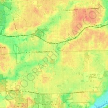
Nome: Mapa topográfico Wheaton, altitude, relevo.
Local: Wheaton, DuPage County, Illinois, 60187, United States (41.81856 -88.15167 41.89533 -88.07539)
Altitude média: 231 m
Altitude mínima: 205 m
Altitude máxima: 248 m
Faça uma doação
Outros mapas topográficos
Clique em um mapa para visualizar sua topografia, sua altitude e seu relevo.
Elmhurst
United States > Illinois > DuPage County
Due to local topography, the town has had a tendency to flood in the past after large rainfalls; the city is currently undertaking a large effort to mitigate future flooding.
Altitude média: 207 m
Elmhurst
United States > Illinois > DuPage County
Due to local topography, the town has had a tendency to flood in the past after large rainfalls; the city is currently undertaking a large effort to mitigate future flooding.
Altitude média: 207 m
Faça uma doação