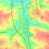
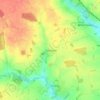
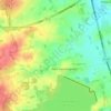
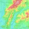
Mapa topográfico Ingatestone
Clique no mapa para exibir a altitude.
Sobre este mapa

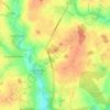
Nome: Mapa topográfico Ingatestone, altitude, relevo.
Local: Ingatestone, Brentwood, Essex, England, CM4 9FH, United Kingdom (51.63107 0.34588 51.71107 0.42588)
Altitude média: 67 m
Altitude mínima: 29 m
Altitude máxima: 103 m
Outros mapas topográficos
Clique em um mapa para visualizar sua topografia, sua altitude e seu relevo.

Connaught Water
United Kingdom > England > Essex > Epping Forest > Sewardstonebury
Altitude média: 57 m
Canvey Island
United Kingdom > England > Essex > Castle Point > Canvey
In 1607 the Elizabethan antiquarian William Camden noted in his work Britannia (a topographical and historical survey of all of Great Britain and Ireland) that Canvey Island (which he called Island Convennon) was documented in the 2nd century by the Alexandrian geographer Ptolemy. In his work Geographia,…
Altitude média: 10 m


River Crouch
United Kingdom > England > Essex
The Crouch rises in 'The Wilderness' on the Burstead Golf course at Little Burstead. The Wilderness consists of several small ponds surrounded by a tiny area of ancient woodland. The ponds date from around 1250, when they were used for the farming of fish for Stockwell Hall, and also served as a defensive moat…
Altitude média: 20 m
Coles Green
United Kingdom > England > Essex > Uttlesford > Berden > Little London
Altitude média: 100 m


Roughtalley's Wood (South) & Epping Forest Woodland Burial Ground
United Kingdom > England > Essex > Epping Forest > Coopersale
Altitude média: 96 m






Great Hallingbury
United Kingdom > England > Essex > Uttlesford > Great Hallingbury
Altitude média: 81 m



Tilbury Juxta Clare
United Kingdom > England > Essex > Braintree > Tilbury juxta Clare
Altitude média: 77 m



Epping Forest
United Kingdom > England > Essex > Epping Forest > Debden Green
It lies on a ridge between the valleys of the rivers Lea and Roding. It contains areas of woodland, grassland, heath, streams, bogs and ponds, and its elevation and thin gravelly soil (the result of glaciation) historically made it less suitable for agriculture. The Forest was historically managed as a common;…
Altitude média: 44 m