
Obrigado por apoiar este site ❤️
Faça uma doação
Faça uma doação
Mapa topográfico Pine
Clique no mapa para exibir a altitude.
Obrigado por apoiar este site ❤️
Faça uma doação
Faça uma doação
Pine
Pine and the adjacent community of Strawberry are rapidly growing vacation and retirement centers in north-central Arizona, below the Mogollon Rim. Pine's elevation is 5,448 feet (1,661 m), and the Pine post office was established in 1884.
Obrigado por apoiar este site ❤️
Faça uma doação
Faça uma doação
Sobre este mapa
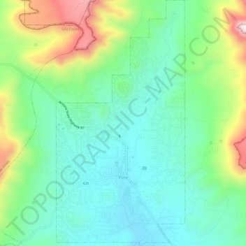
Nome: Mapa topográfico Pine, altitude, relevo.
Local: Pine, Gila County, Arizona, United States (34.37097 -111.47143 34.41879 -111.44099)
Altitude média: 1.794 m
Altitude mínima: 1.613 m
Altitude máxima: 2.221 m
Obrigado por apoiar este site ❤️
Faça uma doação
Faça uma doação