
Faça uma doação
Mapa topográfico El Dorado
Clique no mapa para exibir a altitude.
Faça uma doação
Sobre este mapa
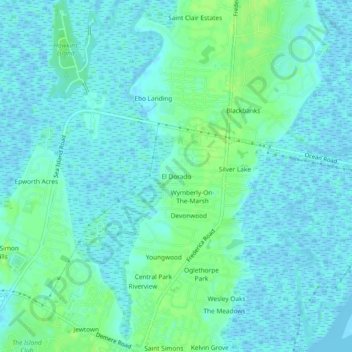
Nome: Mapa topográfico El Dorado, altitude, relevo.
Local: El Dorado, Glynn County, Georgia, 31522, United States (31.15940 -81.40399 31.19940 -81.36399)
Altitude média: 4 m
Altitude mínima: -4 m
Altitude máxima: 11 m
Faça uma doação
Outros mapas topográficos
Clique em um mapa para visualizar sua topografia, sua altitude e seu relevo.
Brunswick
United States > Georgia > Glynn County
The city is the lowest in the U.S. state of Georgia, with an elevation of only 10 to 14 feet (3.0 to 4.3 m) above sea level. According to the U.S. Census Bureau, Brunswick's land area is 32.4 square miles (83.8 km2). Its total area is 42.4 square miles (109.8 km2); 10.0 square miles (26.0 km2) of this is water.
Altitude média: 2 m
Faça uma doação