
Mapa topográfico Nongstoin
Mapa interativo
Clique no mapa para exibir a altitude.
Sobre este mapa
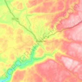
Nome: Mapa topográfico Nongstoin, altitude, relevo.
Local: Nongstoin, West Khasi Hills District, Meghalaya, 793119, India (25.47939 91.22775 25.55939 91.30775)
Altitude média: 1.408 m
Altitude mínima: 1.119 m
Altitude máxima: 1.587 m
Nongstoin is located at 25°31′N 91°16′E / 25.52°N 91.27°E / 25.52; 91.27. It has an average elevation of 1409 metres (4622 feet).e