
Obrigado por apoiar este site ❤️
Faça uma doação
Faça uma doação
Mapa topográfico Dunphail
Clique no mapa para exibir a altitude.
Obrigado por apoiar este site ❤️
Faça uma doação
Faça uma doação
Sobre este mapa
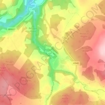
Nome: Mapa topográfico Dunphail, altitude, relevo.
Local: Dunphail, Moray, Scotland, IV36 2QQ, United Kingdom (57.48945 -3.67336 57.52945 -3.63336)
Altitude média: 192 m
Altitude mínima: 83 m
Altitude máxima: 273 m
Obrigado por apoiar este site ❤️
Faça uma doação
Faça uma doação
Outros mapas topográficos
Clique em um mapa para visualizar sua topografia, sua altitude e seu relevo.
Fochabers
United Kingdom > Scotland > Moray
The present village owes its existence to Alexander Gordon, 4th Duke of Gordon (1743–1827). During the late eighteenth century, during the Scottish Enlightenment, it was fashionable for landowners to found new towns and villages; these can be recognised all over Scotland, because unlike their predecessors…
Altitude média: 59 m
Obrigado por apoiar este site ❤️
Faça uma doação
Faça uma doação