
Obrigado por apoiar este site ❤️
Faça uma doação
Faça uma doação
Mapa topográfico Apía
Clique no mapa para exibir a altitude.
Obrigado por apoiar este site ❤️
Faça uma doação
Faça uma doação
Apía
Apía is a town and municipality in the Department of Risaralda, Colombia. It is located at an elevation of 1,630 metres, about 60 km away from district capital Pereira in the valley of the Apia river. It has approximately 11,000 inhabitants according to the 2018 census. The town has excellent views over the Tatamá Hill which is part of the Tatamá Nature Park.
Obrigado por apoiar este site ❤️
Faça uma doação
Faça uma doação
Sobre este mapa
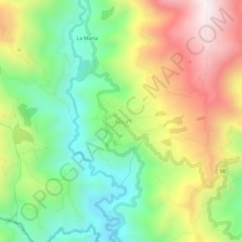
Nome: Mapa topográfico Apía, altitude, relevo.
Local: Apía, Vertiente Occidental, Risaralda, Colombia (5.08655 -75.96250 5.12655 -75.92250)
Altitude média: 1.646 m
Altitude mínima: 1.272 m
Altitude máxima: 2.157 m
Obrigado por apoiar este site ❤️
Faça uma doação
Faça uma doação