
Mapa topográfico Ball Ground
Mapa interativo
Clique no mapa para exibir a altitude.
Sobre este mapa
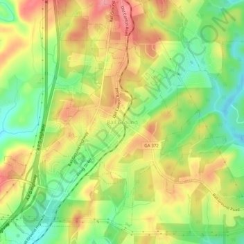
Nome: Mapa topográfico Ball Ground, altitude, relevo.
Local: Ball Ground, Cherokee County, Georgia, 30107, United States (34.31823 -84.39657 34.35823 -84.35657)
Altitude média: 332 m
Altitude mínima: 281 m
Altitude máxima: 383 m
According to the United States Census Bureau, the city has a total area of 5.8 square miles (15.1 km2), of which 0.031 square miles (0.08 km2), or 0.50%, is water. The city's elevation averages around 1,100 feet (340 m) above sea level, ranging from just over 1,000 feet (300 m) in the valleys to around 1,200 feet (370 m) on several hilltops within the city.