
Obrigado por apoiar este site ❤️
Faça uma doação
Faça uma doação
Mapa topográfico Cooperville
Clique no mapa para exibir a altitude.
Obrigado por apoiar este site ❤️
Faça uma doação
Faça uma doação
Sobre este mapa
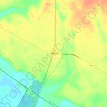
Nome: Mapa topográfico Cooperville, altitude, relevo.
Local: Cooperville, Screven County, Georgia, United States (32.57073 -81.72400 32.61073 -81.68400)
Altitude média: 47 m
Altitude mínima: 22 m
Altitude máxima: 67 m
Obrigado por apoiar este site ❤️
Faça uma doação
Faça uma doação
Outros mapas topográficos
Clique em um mapa para visualizar sua topografia, sua altitude e seu relevo.
Sylvania
United States > Georgia > Screven County
According to the United States Census Bureau, the city has a total area of 3.8 square miles (9.8 km2), all land. Sylvania's elevation is 230 feet and is slightly higher than most of the land throughout Screven County.
Altitude média: 60 m