
Faça uma doação
Mapa topográfico Chetwynd
Clique no mapa para exibir a altitude.
Faça uma doação
Chetwynd
Carved out of an ancient floodplain, the small terrace upon which Chetwynd is situated lies in the northern foothills of the Rocky Mountains. Once used as a grazing spot by nomadic Aboriginals, the terrace was farmed by settlers until it was developed into a town. Two types of soil—namely, the Widmark and Centurion Series—comprise the terrace's surface. The Widmark Series—a moderately well-drained degraded loamy, woody, silty, and clay-like soil—lies north of Highway 97. Meanwhile, the Centurion Series—which lies south of the highway—is a poorly drained soil with a dark-brown peaty surface material consisting of decomposed leaves and mosses. These soils, also limited by topography and stoniness, are generally used for forage and pasture.
Faça uma doação
Sobre este mapa
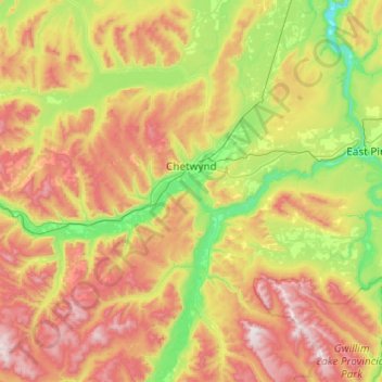
Nome: Mapa topográfico Chetwynd, altitude, relevo.
Altitude média: 910 m
Altitude mínima: 469 m
Altitude máxima: 1.660 m
Faça uma doação