
Mapa topográfico Grenoside
Clique no mapa para exibir a altitude.
Sobre este mapa
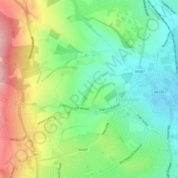
Nome: Mapa topográfico Grenoside, altitude, relevo.
Altitude média: 121 m
Altitude mínima: 57 m
Altitude máxima: 224 m
Outros mapas topográficos
Clique em um mapa para visualizar sua topografia, sua altitude e seu relevo.
Ecclesfield
United Kingdom > England > Sheffield > Whitley
Ecclesfield lies in the north of Sheffield, about 4 miles (7 km) north of the city centre. The suburb of Ecclesfield is in the south-east of the civil parish with the suburbs Chapeltown and High Green to the north, and Grenoside to the west. Its altitude is 60 metres (200 ft) to 120 metres (390 ft) above mean…
Altitude média: 128 m