
Mapa topográfico Best
Mapa interativo
Clique no mapa para exibir a altitude.
Sobre este mapa
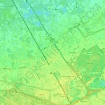
Nome: Mapa topográfico Best, altitude, relevo.
Local: Best, North Brabant, Netherlands (51.48381 5.34936 51.54835 5.44751)
Altitude média: 15 m
Altitude mínima: 6 m
Altitude máxima: 23 m
Outros mapas topográficos
Clique em um mapa para visualizar sua topografia, sua altitude e seu relevo.
's-Hertogenbosch
Netherlands > North Brabant > 's-Hertogenbosch
's-Hertogenbosch, North Brabant, Netherlands
Altitude média: 4 m
Drunen
Netherlands > North Brabant > Drunen
Drunen, Heusden, North Brabant, Netherlands
Altitude média: 6 m
Udenhout
Netherlands > North Brabant > Udenhout
Udenhout, Tilburg, North Brabant, Netherlands
Altitude média: 10 m
Veldhoven
Netherlands > North Brabant > Veldhoven
Veldhoven, North Brabant, Netherlands
Altitude média: 23 m
Mill
Netherlands > North Brabant > Mill en Sint Hubert
Mill, Mill en Sint Hubert, North Brabant, Netherlands
Altitude média: 14 m
Koks
Netherlands > North Brabant > Koks
Koks, North Brabant, Netherlands, 5421, Netherlands
Altitude média: 15 m
Riethoven
Netherlands > North Brabant > Bergeijk
Riethoven, Bergeijk, North Brabant, Netherlands
Altitude média: 26 m