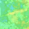
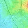
Mapa topográfico Garbsen
Clique no mapa para exibir a altitude.
Garbsen
Garbsen belongs to the Weser-Aller-Flachland natural area and is situated between the lowlands of the river Leine and the Otternhagener Moor. The differences in altitude are only a few metres.
Sobre este mapa

Nome: Mapa topográfico Garbsen, altitude, relevo.
Local: Garbsen, Region Hannover, Lower Saxony, Germany (52.39799 9.48440 52.50121 9.64537)
Altitude média: 50 m
Altitude mínima: 39 m
Altitude máxima: 64 m
Outros mapas topográficos
Clique em um mapa para visualizar sua topografia, sua altitude e seu relevo.