
Faça uma doação
Mapa topográfico Pico Duarte
Clique no mapa para exibir a altitude.
Faça uma doação
Pico Duarte
Pico Duarte is the highest peak in the Dominican Republic, on the island of Hispaniola and in all the Caribbean. At 3,101 m (10,174 ft) above sea level, it gives Hispaniola the 16th-highest maximum elevation of any island in the world. Additionally, it is only 85 kilometres (53 miles) northeast of the region's lowest point, Lake Enriquillo, 46 m (151 ft) below sea level. It is part of the Cordillera Central range, which extends from the plains between San Cristóbal and Baní to the northwestern peninsula of Haiti, where it is known as the Massif du Nord. The highest elevations of the Cordillera Central are found in the Pico Duarte and Valle Nuevo massifs.
Faça uma doação
Sobre este mapa
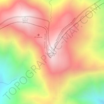
Nome: Mapa topográfico Pico Duarte, altitude, relevo.
Altitude média: 2.750 m
Altitude mínima: 2.198 m
Altitude máxima: 3.093 m
Faça uma doação