
Obrigado por apoiar este site ❤️
Faça uma doação
Faça uma doação
Mapa topográfico Jirishanca
Clique no mapa para exibir a altitude.
Obrigado por apoiar este site ❤️
Faça uma doação
Faça uma doação
Jirishanca
The altitude of 6125 isn't likely as other data from available digital elevation models show lower elevations: SRTM yields 6028 metres and TanDEM-X 5734 metres. The height of the nearest key col is 5610 meters, leading to a topographic prominence of 484 meters. Jirishanca is considered a Mountain according to the Dominance System and its dominance is 7.94%. Its parent peak is Yerupaja and the Topographic isolation is 3.5 kilometers.
Obrigado por apoiar este site ❤️
Faça uma doação
Faça uma doação
Sobre este mapa
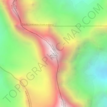
Nome: Mapa topográfico Jirishanca, altitude, relevo.
Local: Jirishanca, Pacllón, Province of Bolognesi, Ancash, Peru (-10.23703 -76.90579 -10.23693 -76.90569)
Altitude média: 5.198 m
Altitude mínima: 4.510 m
Altitude máxima: 5.907 m
Obrigado por apoiar este site ❤️
Faça uma doação
Faça uma doação