
Faça uma doação
Mapa topográfico Harrow
Clique no mapa para exibir a altitude.
Faça uma doação
Sobre este mapa
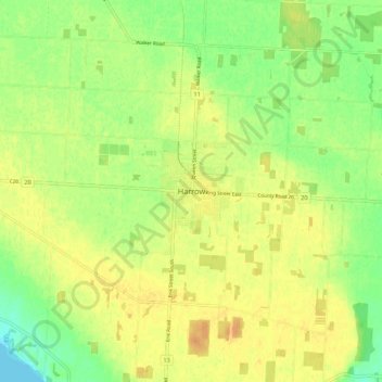
Nome: Mapa topográfico Harrow, altitude, relevo.
Altitude média: 189 m
Altitude mínima: 172 m
Altitude máxima: 201 m
Faça uma doação
Outros mapas topográficos
Clique em um mapa para visualizar sua topografia, sua altitude e seu relevo.
Faça uma doação
Lakeshore
Canada > Ontario > Essex County
As in the rest of Essex County and Chatham-Kent, the terrain is extremely flat and regular. The terrain slopes very gently from the southern border of Lakeshore on Highway 8, with an average elevation of 188 m (617 ft), to the shore of Lake St. Clair at 176 m (577 ft). The highest land is in the southwestern…
Altitude média: 183 m
Faça uma doação