
Mapa topográfico Crowborough
Clique no mapa para exibir a altitude.
Crowborough
In the late 19th century Crowborough was promoted as a health resort based on its high elevation, the rolling hills and surrounding forest. Estate Agents even called it "Scotland in Sussex". The town's golf course opened in 1895, followed by a fire station and hospital in 1900.
Sobre este mapa
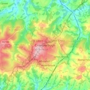
Nome: Mapa topográfico Crowborough, altitude, relevo.
Altitude média: 125 m
Altitude mínima: 48 m
Altitude máxima: 244 m