
Obrigado por apoiar este site ❤️
Faça uma doação
Faça uma doação
Mapa topográfico Cayambe
Clique no mapa para exibir a altitude.
Obrigado por apoiar este site ❤️
Faça uma doação
Faça uma doação
Cayambe
Cayambe or Volcán Cayambe is a volcano in Ecuador, in the Cordillera Central, a range of the Ecuadorian Andes. It is located in Pichincha Province, some 70 km (43 mi) northeast of Quito. It is the third-highest mountain in Ecuador, at an elevation of 5,790 m (18,996 ft) above sea level.
Obrigado por apoiar este site ❤️
Faça uma doação
Faça uma doação
Sobre este mapa
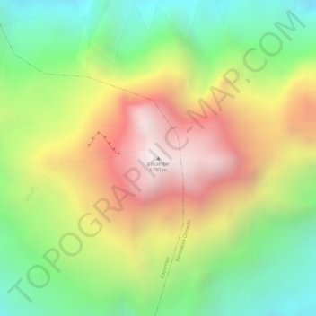
Nome: Mapa topográfico Cayambe, altitude, relevo.
Local: Cayambe, Pichincha, Ecuador (0.02511 -77.98901 0.02521 -77.98891)
Altitude média: 5.246 m
Altitude mínima: 4.752 m
Altitude máxima: 5.783 m
Obrigado por apoiar este site ❤️
Faça uma doação
Faça uma doação