
Faça uma doação
Mapa topográfico Ruth
Clique no mapa para exibir a altitude.
Faça uma doação
Ruth
Ruth is a census-designated place (CDP) in Trinity County, California.[2] Ruth is located in the southern portion of the county. The community - and adjacent Ruth Lake - was named after Ruth McKnight, daughter of settlers. The ZIP code is 95526.[3] The community is inside area code 707. It is located near the headwaters of the Mad River (California) and adjacent to the Yolla Bolly-Middle Eel Wilderness. Ruth sits at an elevation of 2,933 feet (894 m).[2] Its population is 254 as of the 2020 census, up from 195 from the 2010 census.
Faça uma doação
Sobre este mapa
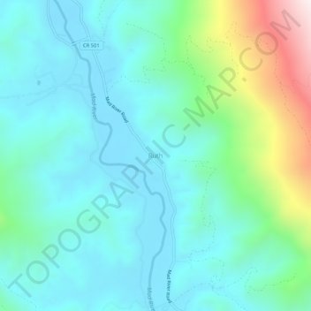
Nome: Mapa topográfico Ruth, altitude, relevo.
Local: Ruth, Trinity County, California, United States (40.24959 -123.34141 40.28959 -123.30141)
Altitude média: 996 m
Altitude mínima: 814 m
Altitude máxima: 1.666 m
Faça uma doação
Outros mapas topográficos
Clique em um mapa para visualizar sua topografia, sua altitude e seu relevo.
Whiskeytown-Shasta-Trinity National Recreation Area - Trinity Unit
United States > California > Trinity County
Altitude média: 1.149 m
Faça uma doação