
Mapa topográfico Sas de Stria
Mapa interativo
Clique no mapa para exibir a altitude.
Sas de Stria
Sass de Stria is a mountain of the Veneto, Italy. It has an elevation of 2,477 meters. During the First World War, the mountain and surrounding area was the scene of fighting between Italy and Austria-Hungary.
Sobre este mapa
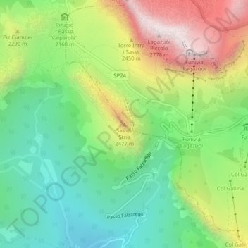
Nome: Mapa topográfico Sas de Stria, altitude, relevo.
Local: Sas de Stria, Cortina d'Ampezzo, Belluno, Veneto, Italy (46.51988 11.99782 46.51998 11.99792)
Altitude média: 2.138 m
Altitude mínima: 1.751 m
Altitude máxima: 2.757 m