Geolocalizar

Mapa topográfico Staythorpe CP

Mapa interativo

Clique no mapa para exibir a altitude.

Sobre este mapa

Nome: Mapa topográfico Staythorpe CP, altitude, relevo.

Local: Staythorpe CP, Newark and Sherwood, Nottinghamshire, England, United Kingdom (53.06644 -0.89217 53.08617 -0.85220)

Altitude média: 16 m

Altitude mínima: 9 m

Altitude máxima: 58 m

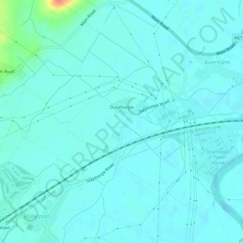
The land is very low-lying and level, varying little in elevation between 12–14 metres (39–46 ft) throughout.

Wikipedia (CC-BY-SA 3.0)

Outros mapas topográficos

Clique em um mapa para visualizar sua topografia, sua altitude e seu relevo.

Newark on Trent

United Kingdom > England > Nottinghamshire > Newark and Sherwood

Newark on Trent, Newark and Sherwood, Nottinghamshire, England, NG24 1EJ, United Kingdom

Altitude média: 18 m

Southwell CP

United Kingdom > England > Nottinghamshire > Newark and Sherwood

Southwell CP, Newark and Sherwood, Nottinghamshire, England, United Kingdom

Altitude média: 47 m

Goverton

United Kingdom > England > Nottinghamshire > Newark and Sherwood > Bleasby

Goverton, Bleasby, Newark and Sherwood, Nottinghamshire, England, NG14 7FN, United Kingdom

Altitude média: 33 m