Mapa topográfico West Shield Row Villas
Mapa interativo
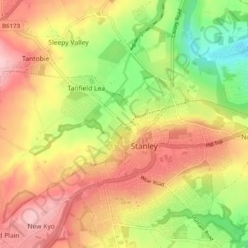
Clique no mapa para exibir a altitude.
Sobre este mapa
Nome: Mapa topográfico West Shield Row Villas, altitude, relevo.
Altitude média: 180 m
Altitude mínima: 90 m
Altitude máxima: 257 m

Clique no mapa para exibir a altitude.
Nome: Mapa topográfico West Shield Row Villas, altitude, relevo.
Altitude média: 180 m
Altitude mínima: 90 m
Altitude máxima: 257 m