
Mapa topográfico Paynesville
Mapa interativo
Clique no mapa para exibir a altitude.
Sobre este mapa
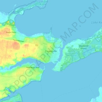
Nome: Mapa topográfico Paynesville, altitude, relevo.
Altitude média: 5 m
Altitude mínima: -4 m
Altitude máxima: 34 m
Outros mapas topográficos
Clique em um mapa para visualizar sua topografia, sua altitude e seu relevo.
Steel Bay - Newland Backwater Gippsland Lakes Reserve
Australia > Victoria > Paynesville
Steel Bay - Newland Backwater Gippsland Lakes Reserve, Goon Nure, Paynesville, Shire of East Gippsland, Victoria, Australia
Altitude média: 17 m
Raymond Island
Australia > Victoria > Paynesville
Raymond Island, Paynesville, Shire of East Gippsland, Victoria, 3880, Australia
Altitude média: 2 m