
Mapa topográfico Arosa
Mapa interativo
Clique no mapa para exibir a altitude.
Sobre este mapa
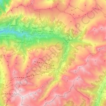
Nome: Mapa topográfico Arosa, altitude, relevo.
Local: Arosa, Plessur, Grisons, Switzerland (46.72958 9.58322 46.87360 9.80700)
Altitude média: 1.985 m
Altitude mínima: 694 m
Altitude máxima: 2.959 m
Before 2017, the municipality was in the Schanfigg sub-district of the Plessur district, after that date it was part of the Plessur Region. Located on the south-east slope of the Weisshorn chain, the town of Arosa is at the top of the Schanfigg valley at the foot of the Aroser Weisshorn (2,653 m (8,704 ft)). Adjoining are the areas of Innerarosa, Dorf-Obersee, Untersee and Maran-Prätschli at an elevation of 1,690 and 1,950 meters (5,540 and 6,400 ft).