
Mapa topográfico Puurs
Mapa interativo
Clique no mapa para exibir a altitude.
Puurs
Puurs sits about 5 meters above mean sea level. Its geography shows only minor elevation differences. Puurs is mainly rural, with some low intensity industry development in the North alongside the N16 expressway. However, because of its proximity to the cities of Antwerp and Brussels (both within a 25 km (16 mi) radius) and its excellent accessibility, Puurs is developing increasingly into a residential town.
Sobre este mapa
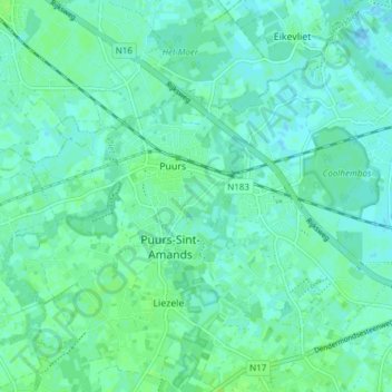
Nome: Mapa topográfico Puurs, altitude, relevo.
Altitude média: 4 m
Altitude mínima: -1 m
Altitude máxima: 9 m