
Mapa topográfico Doi Suthep
Mapa interativo
Clique no mapa para exibir a altitude.
Sobre este mapa
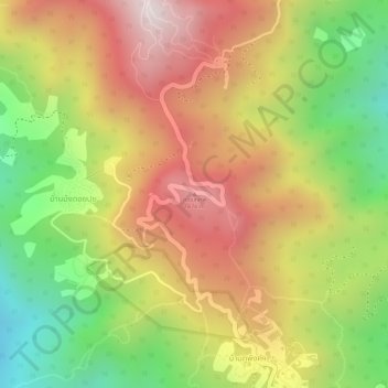
Nome: Mapa topográfico Doi Suthep, altitude, relevo.
Altitude média: 1.351 m
Altitude mínima: 983 m
Altitude máxima: 1.660 m
Doi Suthep (ดอยสุเทพ), is a mountain ("doi") west of Chiang Mai, Thailand. It is 1,676 metres (5,499 ft) in elevation and is one of the twin peaks of a granite mountain. The other peak is known as Doi Pui and is slightly higher (1,685 metres (5,528 ft)).