
Mapa topográfico Saintes
Mapa interativo
Clique no mapa para exibir a altitude.
Sobre este mapa
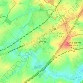
Nome: Mapa topográfico Saintes, altitude, relevo.
Altitude média: 61 m
Altitude mínima: 35 m
Altitude máxima: 98 m
Outros mapas topográficos
Clique em um mapa para visualizar sua topografia, sua altitude e seu relevo.
Le Stierbecq
Belgique > Brabant wallon > Nivelles > Tubize
Le Stierbecq, Tubize, Nivelles, Brabant wallon, Wallonie, Belgique
Altitude média: 55 m
Oisquercq
Belgique > Brabant wallon > Nivelles > Tubize
Oisquercq, Tubize, Nivelles, Brabant wallon, Wallonie, Belgique
Altitude média: 76 m
Clabecq
Belgique > Brabant wallon > Nivelles > Tubize
Clabecq, Tubize, Nivelles, Brabant wallon, Wallonie, Belgique
Altitude média: 58 m